Sichuan–Tibet Highway (G318) · Sichuan

Sichuan–Tibet Highway Tours & Private G318 Overland Trips 2026 | Chengdu to Lhasa via Kangding, Litang, Ranwu & Nyingchi | JoyoTour

The G318 Sichuan–Tibet Highway runs 2,142 km from Chengdu to Lhasa over 4,000 m passes and four great rivers — 10 days by 4x4 covers the whole southern route.

The short version

The Sichuan–Tibet Highway is the southern G318 route between Chengdu and Lhasa — 2,142 km crossing 14 high passes and four great rivers (Jinsha, Lancang, Nu, Yarlung Tsangpo), with the road climbing from 500 m to over 5,000 m. A 4x4 with driver covers it in 10 days; cyclists take about a month. The road is mostly paved now, but the Tongmai gorge and the 72-turn Nujiang switchbacks are still genuinely dangerous. Foreign passport holders need a Tibet Travel Permit arranged at least 20 working days ahead, and cannot travel independently.

SichuanProvince
May–June and September–October; avoid the July–August rainy season and the winter ice on the passesBest months
CTUAirport
YesDaily intl. flights
Prefer it arranged for you? 2,142 kilometres of cliff-edge switchbacks, four of China's most beautiful mountains, and a road the Tibetans walk on their knees. Sichuan–Tibet Highway (G318) travel guide →

The place itself

What Sichuan–Tibet Highway (G318) is actually like

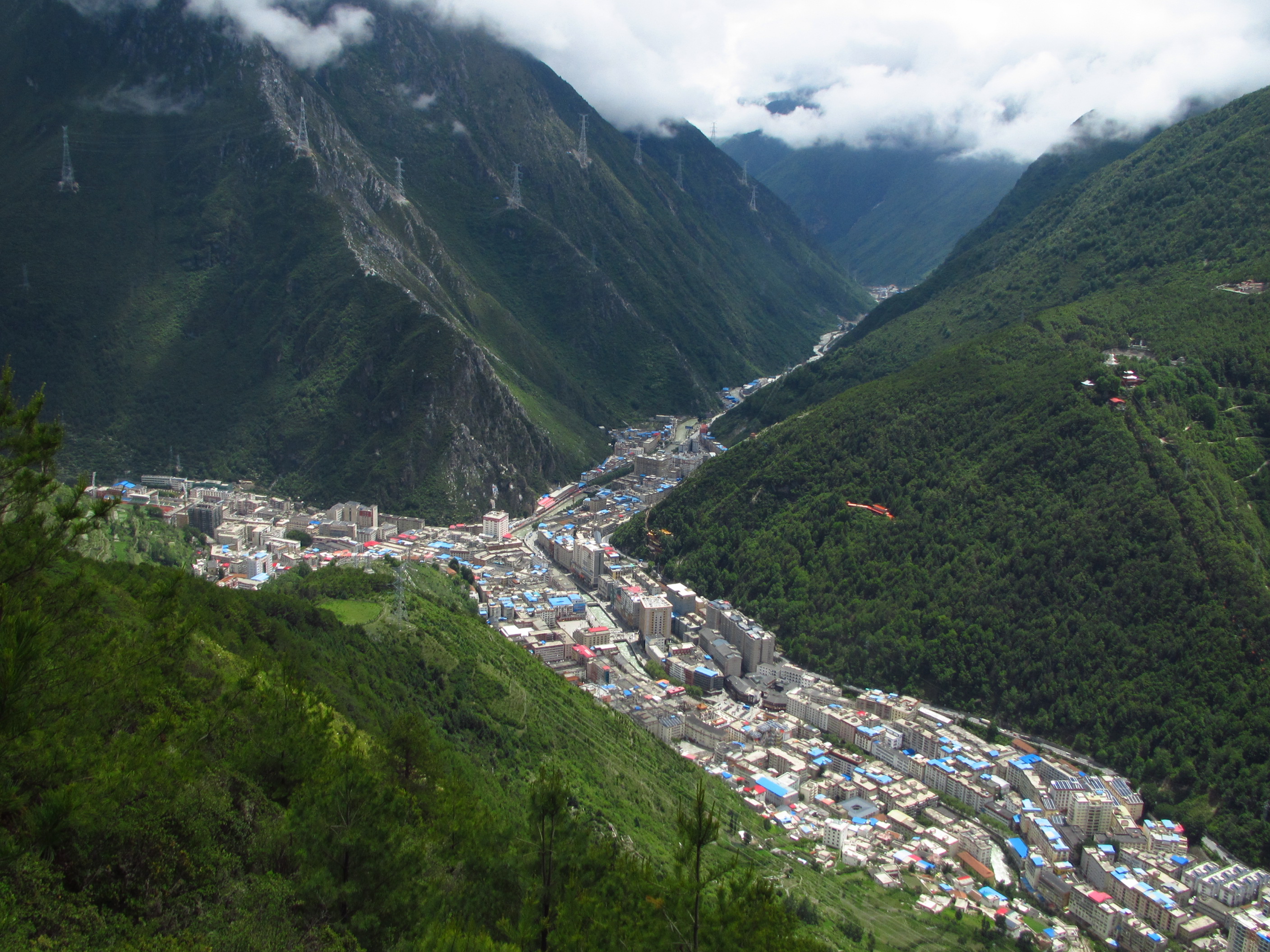
Of all the roads into Tibet, this is the one people dream about. The G318 southern route leaves the Sichuan basin at Chengdu and grinds its way up through the Hengduan Mountains — a range of parallel ridges and river gorges so steep that the road gains and loses 2,000 m in a single afternoon. You cross the Jinsha, Lancang, Nu and Yarlung Tsangpo rivers, climb over the Erlang, Zheduo, Jinsha and Nyainqentanglha ranges, and finish on the Tibetan plateau at Lhasa.

The landscape changes faster than the altitude gauge can keep up. Bamboo forest and tea terraces near Ya'an give way to the spruce and yak pastures of Tagong, then to the bare rock and glacial moraine of the high passes, and finally to the birch forests and turquoise lakes of Nyingchi — often called Tibet's Jiangnan, the land of milk and honey. Ranwu Lake, Namcha Barwa and the endless switchbacks of the Nujiang canyon are the images that stay with people.

It is also a working road, not a theme park. Tibetan pilgrims still prostrate their way to Lhasa over three years, truck convoys haul freight up from Sichuan, and every county runs a speed-permit checkpoint system that forces even impatient drivers to stop and wait. Travel it by 4x4 with a driver who knows the passes, and it is one of the great overland journeys in Asia.

75°E75°E90°E90°E105°E105°E120°E120°E135°E135°E20°N20°N30°N30°N40°N40°N50°N50°N ChangchunKashgar BeijingBeijingXi'anXi'anShanghaiShanghaiChengduChengduGuilinGuilinHangzhouHangzhouZhangjiajieZhangjiajieTibet · LhasaTibet · LhasaYunnan · KunmingYunnan · KunmingSichuan · ChengduSichuan · ChengduQinghai · XiningQinghai · XiningGansu · LanzhouGansu · LanzhouXinjiang · UrumqiXinjiang · UrumqiInner Mongolia · HohhotInner Mongolia · HohhotGuangzhouGuangzhouShenzhenShenzhenHarbinHarbinDalianDalianShenyangShenyangChangbai MountainChangbai MountainKunmingKunmingDaliDaliShuheShuheLijiangLijiangXiamenXiamenGulangyuGulangyuFuzhouFuzhouLugu LakeLugu LakeXishuangbanna · JinghongXishuangbanna · JinghongShangri-LaShangri-LaNanchangNanchangHefeiHefeiHongcunHongcunWuhanWuhanChangshaChangshaFenghuang Ancient TownFenghuang Ancient TownLushanLushanWuyuanWuyuanMount Heng (Hengshan, Hunan)Mount Heng (Hengshan, Hunan)HuangshanHuangshanWudang MountainWudang MountainLuoyangLuoyangYuntai MountainYuntai MountainRizhaoRizhaoYantaiYantaiLianyungangLianyungangSanqing MountainSanqing MountainTianjinTianjinDatongDatongTaiyuanTaiyuanPingyaoPingyaoWutai MountainWutai MountainHulunbuir · HailarHulunbuir · HailarThe Forbidden CityThe Forbidden CitySanyaSanyaHaikouHaikouBeihaiBeihaiNanningNanningGuangxi · NanningGuangxi · NanningHuizhouHuizhouZhuhaiZhuhaiWuyi MountainWuyi MountainBeidaiheBeidaiheShanhaiguanShanhaiguanBaiyangdianBaiyangdianQinhuangdaoQinhuangdaoYesanpoYesanpoJiuzhaigouJiuzhaigouMount SiguniangMount SiguniangHailuogouHailuogouDaocheng YadingDaocheng YadingShunan Bamboo SeaShunan Bamboo SeaDujiangyanDujiangyanQingcheng MountainQingcheng MountainQingdaoQingdaoMount TaiMount TaiJinanJinanWeihaiWeihaiQufuQufuPenglaiPenglaiChangdaoChangdaoNanjingNanjingSuzhouSuzhouZhouzhuangZhouzhuangTongliTongliWuxiWuxiYangzhouYangzhouZhenjiangZhenjiangChangzhouChangzhouWuzhenWuzhenXitangXitangXixi WetlandXixi WetlandNingboNingboMount PutuoMount PutuoQiandao LakeQiandao LakeShaoxingShaoxingZhoushanZhoushanHengdianHengdianYandang MountainYandang MountainZhejiang · HangzhouZhejiang · HangzhouHong KongHong KongHong Kong Outlying IslandsHong Kong Outlying IslandsHong Kong ShoppingHong Kong ShoppingMacaoMacaoTaipeiTaipeiKaohsiungKaohsiungTaiwan · TaipeiTaiwan · TaipeiUrumqiUrumqiNorth Xinjiang · UrumqiNorth Xinjiang · UrumqiQinghai LakeQinghai LakeMount EmeiMount EmeiLanzhouLanzhouMount HuaMount HuaDunhuangDunhuangGannan · LanzhouGannan · LanzhouSichuan–Tibet Highway (G318) · Chengdu (CTU)Sichuan–Tibet Highway (G318) · Chengdu (CTU)KangdingKangdingLhasaLhasaNyingchiNyingchiNamtsoNamtsoChongqingChongqingQiandongnan · GuiyangQiandongnan · GuiyangLiboLiboGuiyangGuiyangZhenyuanZhenyuanHuangguoshuHuangguoshu
Destination — click to open the guide Province or autonomous region Provincial capital Major river

Pins are plotted from real latitude and longitude on a 5° graticule. This is a schematic orientation diagram, not a political map — no boundaries are drawn.

What not to miss — Sichuan–Tibet Highway (G318)

01

G318, China's 'Landscape Highway'

The 5,000 km Shanghai–Zhangmu road is nicknamed the nation's most beautiful drive, and this Chengdu–Lhasa stretch is its crown. Expect snow peaks, forested gorges, grassland, river valley farmland and Tibetan villages to appear in a single day's driving.

02

Four mountains from China's Top Ten

Namcha Barwa (7,782 m, ranked No.1) is visible from the Sejila Pass near Nyingchi on a clear day. Minya Konka (No.2, 7,556 m) rises south of Kangding and can be seen from Zheduo Pass. The Yading trio and Meili Snow Mountain sit just off the route on side trips.

03

Alpine lakes along the road

Ranwu Lake on the Bomi stretch, Basum Tso near Kongpo Gyamda, and Mugecuo outside Kangding all sit within a short detour of the highway. Colour shifts by season from milky jade to deep cobalt.

04

The 72-turn Nujiang switchbacks

From the Yela Pass at 4,600 m the road drops 2,000 m to the Nujiang bridge in about 20 km of continuous hairpins. It is fully paved since 2010 but blind corners with oncoming trucks make it the most memorable driving on the route.

05

Tongmai gorge, the last hard section

The cliff-hugging stretch along the Parlung Tsangpo between Bomi and Nyingchi still closes after heavy rain. Landslides are routine; drive it in daylight and never in a hurry.

06

Lhasa and the Potala

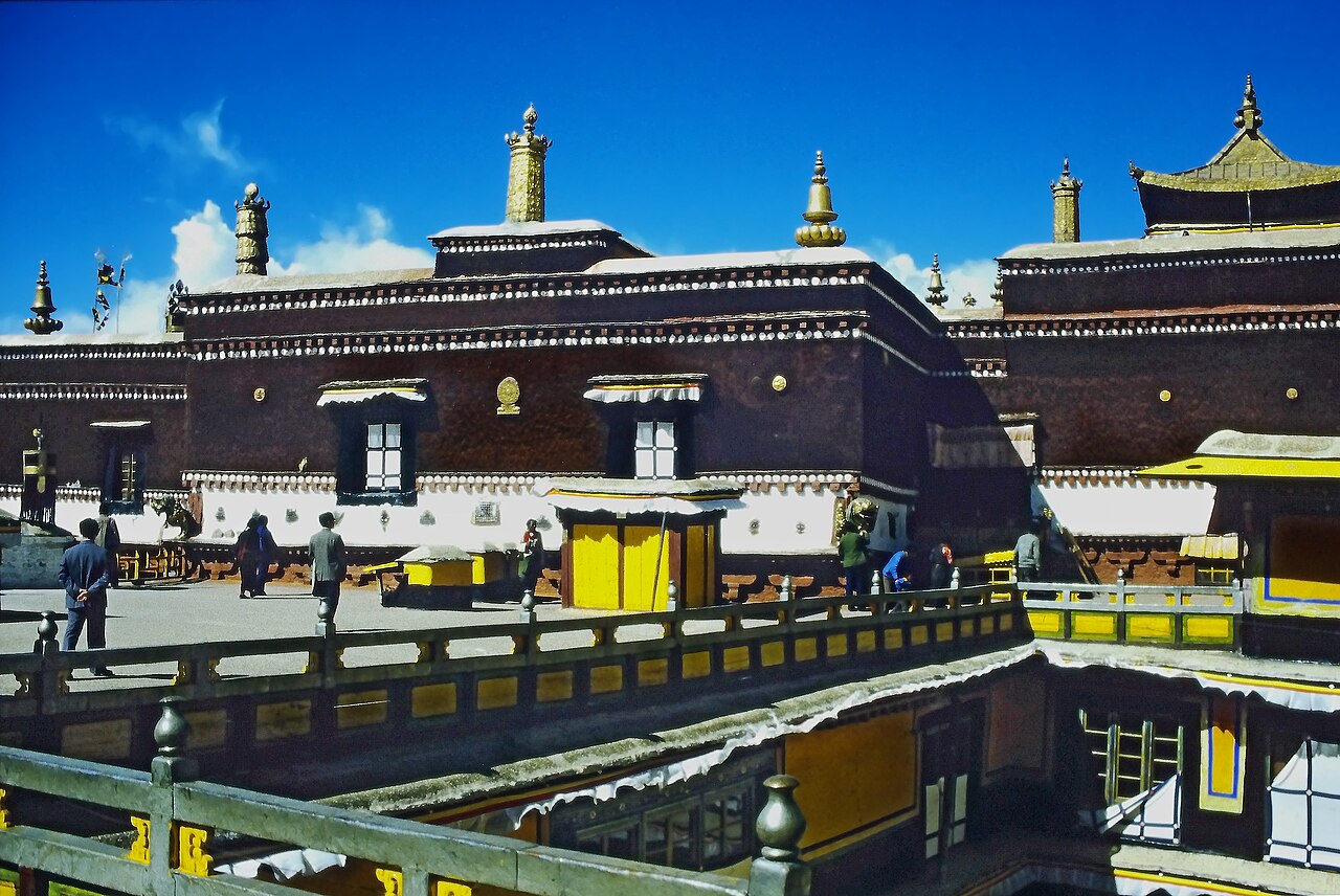
The road ends at the Jokhang and the Potala Palace, plus Namtso Lake — a 4,718 m saltwater lake about 4 hours north of the city and the classic add-on for a first visit.

Getting there and away

Almost everyone starts at Chengdu, the transport hub of western China. Chengdu Shuangliu International Airport (CTU) handles domestic and international flights, and the newer Tianfu airport (TFU) takes most long-haul services. From the airport, shuttle buses run to the city centre every 15 minutes for CNY 8–10 and take about 30 minutes; taxis run around CNY 50. Chengdu has three main railway stations — the North Station (Chengdu Zhan) has the most services, the East Station mostly high-speed — and long-distance buses for Kangding leave from the Xinnanmen tourist bus station (07:00–19:00, roughly every 30 minutes, CNY 100–130, 7 hours). If you are flying in from overseas, give yourself one full day in Chengdu to acclimatise and buy last-minute supplies before heading up.

Once on the road, the practical choices are chartered 4x4 with driver, self-drive, public bus, hitchhiking or bicycle. The 10-day itinerary in this guide assumes a 4x4 or chartered vehicle — that's the only way to stop where you want and reach the small towns before dark. Public buses link the county towns (Kangding, Litang, Batang, Markam) but rarely line up with the scenery. Cyclists need about a month; trekkers on foot about six months; pilgrims doing full prostrations take three years. Note the local speed-permit system (限速卡): from Batang onward, every county checkpoint issues a slip stamped with an arrival time for the next checkpoint, effectively capping you at about 42–43 km/h. Arrive early and you wait at the roadside; the permit is checked at the next barrier.

Best time to visit — Sichuan–Tibet Highway (G318)

MonthWeatherCrowdsVerdict
January2°C / -12°C · bitterly cold, clearQuietAvoid
February5°C / -9°C · bitterly cold, clearVery busyAvoid
March10°C / -3°C · bitterly cold, clearModerateGood
April15°C / 3°C · bitterly cold, clearModerateGood
May19°C / 8°C · bitterly cold, clearBusyOK
June22°C / 12°C · clear and mildModerateBest
July23°C / 14°C · clear and mildBusyBest
August22°C / 13°C · clear and mildBusyBest
September19°C / 9°C · clear and mildModerateBest
October14°C / 2°C · bitterly cold, clearVery busyGood
November7°C / -6°C · bitterly cold, clearQuietGood
December2°C / -11°C · bitterly cold, clearQuietAvoid

How many days do you need?

Ten days is the classic number: one day in Chengdu, seven days on the road to Lhasa, and two days for the Potala, Jokhang and Namtso Lake. That's already a fast pace. Adding three to four days lets you detour to Yading Nature Reserve south of Litang (3 days), Gongga and Hailuogou from Kangding (2 days), or Meili Snow Mountain via Deqin from Markam (2 days). Budget at least one full rest day somewhere above 3,500 m — Litang or Ranwu are the usual choices — or the altitude will catch up with you.

Plan these days properly

Frequently asked questions

What is the best season to drive the Sichuan–Tibet Highway?

September and October are best — dry, clear skies, golden birch forest along the Bomi and Nyingchi stretches, and stable roads. May and June are a good second choice with wildflowers and rhododendrons in bloom. Avoid July and August: that's peak rainy season, with mudslides and road closures on the Tongmai gorge and the Nujiang switchbacks, and lodging prices double or triple.

How dangerous is the Sichuan–Tibet Highway really?

The road is fully paved and much safer than it was a decade ago, but two sections still demand caution: the Tongmai gorge between Bomi and Nyingchi, where landslides routinely close the road, and the 72-turn Nujiang descent from the Yela Pass. Drive both in daylight, never in heavy rain, and with a driver who has done them before. Traffic accidents, not altitude, are the real risk.

Do I need a permit to travel the Sichuan–Tibet Highway?

Chinese nationals need only their ID card for the route as far as Lhasa. Foreign passport holders, Taiwanese travellers and overseas Chinese (except Hong Kong and Macao residents with a Home Return Permit) need a Tibet Travel Permit issued by the Tibet Tourism Bureau, plus a licensed Tibetan guide, arranged at least 20 working days ahead through a travel agency. Journalists and diplomats cannot enter Tibet on a tourist visa.

How do I handle altitude sickness on the route?

Mild symptoms — headache, fatigue, insomnia — usually clear within one to two days as your body adapts. Before you go: no alcohol or smoking, avoid catching a cold (a cold at altitude can turn into pulmonary oedema), and start taking rhodiola tablets a few days early. On the road: eat vegetables and fruit, drink water, sleep well, and do not run or jump at the passes. Do not reach for the oxygen canister at the first headache — it creates dependency. Butter tea is the traditional remedy; it works.

How much does the Sichuan–Tibet Highway trip cost?

A chartered 4x4 with driver-guide for the full 10-day route runs about CNY 10,000 per person when split between three or four passengers. Hitchhiking and taking local buses brings that down to around CNY 3,000 per person, but you lose control of your own timing and may get stuck waiting for a ride. Bring enough cash for fuel, food and lodging — ATMs exist in the main county towns but are unreliable on the smaller stretches.

How many days do I need for the Sichuan–Tibet Highway?

Ten days is the standard 4x4 itinerary: one day in Chengdu, seven days on the road, two days in Lhasa for the Potala, Jokhang and Namtso. A non-stop 4x4 push covers the 2,142 km in three to four days, but you'd see almost nothing. Cyclists need about a month; on foot, roughly six months.

Tell us your dates.
We'll do the rest.

Free itinerary design, a revised plan within one working day, and nothing charged until you approve the final version.

  • Free itinerary planning by a destination specialist
  • A revised draft within one working day
  • Nothing is charged until you approve the final version.

No spam. No sales calls. Just a real itinerary from a real person.